


Unfolding Kapitulská
Augmented Reality Wayfinding
Concept, design, development: Filip Ruisl, Jonathan Ravasz
Academic guidance: Marcel Bencik, Pavel Choma at AFAD
Research data provided by Slovak National Archive
and OZ Oživenie Kapitulskej
Finished: May 2015
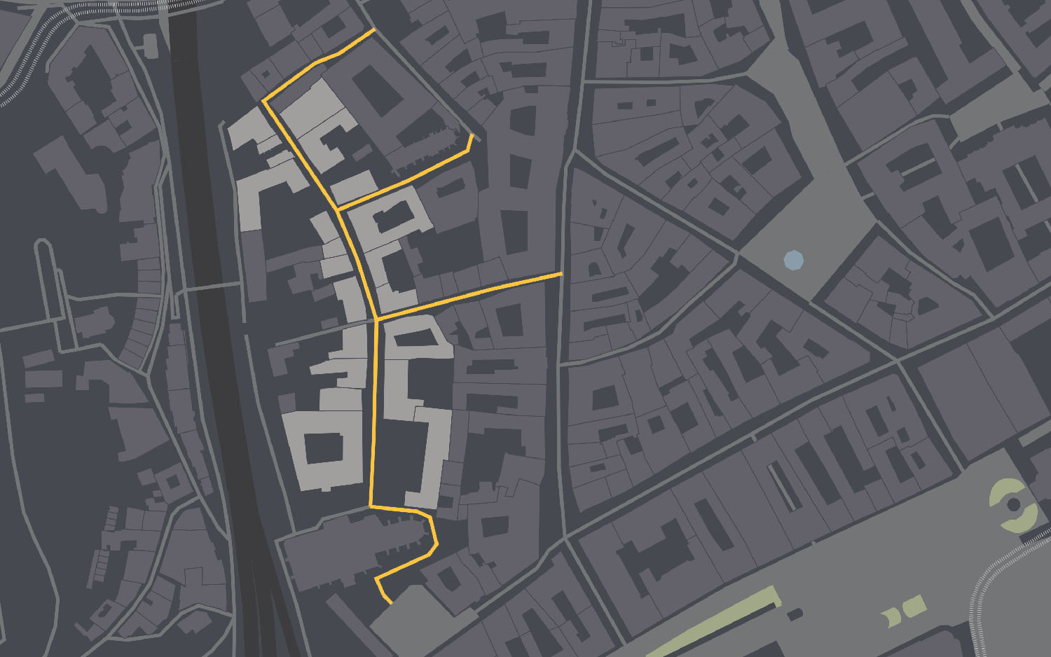
Kapitulská street is one of the oldest streets of Bratislava, located in the heart of the Old Town. Unfortunately currently the street is in ruins, except a few renovated houses. The qualities of the street are fairly unknown even to the locals, despite the fact that it was once the meeting point of the Bratislava intellectuals (composers, musicians, writers, doctors). Kapitulská street is probably the last historical street of Bratislava free of any visual smog, serving as an isle for relaxation in the centre of the capital.


Kick-off
The department of visual communication at the Academy of Fine Arts and Design in Bratislava was commissioned to design an information system for the street. The commission came from the civic association Oživenie Kapitulskej. After a public excursion of the street we decided to dedicate ourselves to the project.


Initial research
We began our research by lending all available information from the Slovak National Archive in Bratislava. They provided us blueprints and short architectural analyses about each building of the street alongside detailed hand-drawn blueprints of the facades and entrace gates.


We recognised, that a simple information system would not be able to open up this unrevealed data to the public.


Concept and approach
Despite the initial commission, we decided not to work with a physical information system. We wanted to keep the street free of any intervention, yet we wanted to create a complex, functional system. Our approach consisted of three main parts: visual identity, wayfinding system and individual storytelling for each building.
Logotype
Due to it’s low profile the street needed a distinguishable visual identity from the general identity of the Old Town. We decided to work with the architecture of the street. We generated a logotype for each building using the blueprints of the façades. The silhouette of each building was redrawn to a grid system using Nodebox. This way we created a dynamic logotype for the street and a unique symbol for each building.
Wayfinding
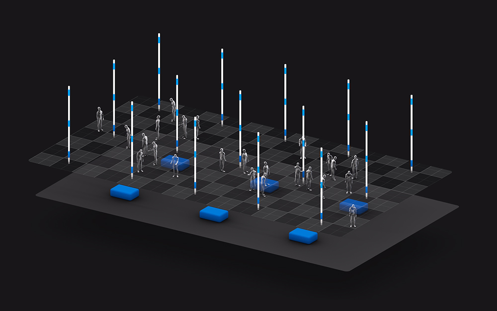
Since we were trying to avoid any physical intervention we decided to approach wayfinding through augmented reality. We designed the application in which the user is able to view the street through the lens of a smartphone or tablet. The application connects pins to each building, revealing its historical name. We also designed a 2D navigation system, using geolocation. The user is placed on a sideview map, where silhouettes from the logotype represent each building.


Renovation using AR
Augmented reality allowed us to map the original facades of the buildings into the live camera image. The user would be able switch between “architectural drawing view” and rendered view, recreating the original appeal of the buildings over the ruins. A functional prototype was also developed for the project using Unity3D and Vuforia. The prototype is currently working with one of the old palaces of the street, it recognises the building using a stitched photograph as a marker.


Storytelling
Users would reveal the description, stories and notable people of the buildings by tapping either the floating pins connected to the buildings or the silhouettes on the 2D map. We also integrated a photo gallery to show the interiors and gardens behind the closed gates.


Pocket map
The last output of the project was a printed pocket map. The pocket map contains an offline version of the 2D map, as well as the stories and descriptions from the app. It could be given to tourists and locals at the local information points.


